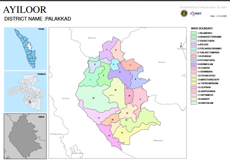
Geography
Panchayat Boundaries
East: Nenmara Grama Panchayat, forest area
West: Vandazhi Grama Panchayat
South: Vandazhi Grama Panchayat
North: Melarkode Grama Panchayat
Located in the south of Palakkad district. The terrain includes the Ayilamudi hills and valleys, which are part of the Sahya Parvatha range. The Ayilur River flowing through the north of Ayilur Grama Panchayat, the Kalchadi River flowing through the south, and the Nerchapara River are drying up. A total of 4 check dams have been built. Since they cannot be properly maintained, there is no water supply in the summer. There is a reserve forest in the south.
The terrain is about 500 feet above sea level. The area is hilly and plains and receives more than 3000 cm of rainfall. The soil is loamy mixed with gravel. Paddy cultivation is carried out depending on the water of the Ayilur River flowing through the Nenmara Grama Panchayat in the north-east and the Pothundi Irrigation Canal. Although there is abundant rainfall, drought is also common. The hot winds from the Palakkad pass also affect Ayilur Panchayat. The temperature is between 25 degrees and 40 degrees. Due to the lack of irrigation water, crops such as rubber, coconut, and pepper are being cultivated more and wetlands are disappearing. The change in farming methods is once again making the land barren.